

NASA Engineers Build Data Virtuality – Harnessing the Power of VR for Better Data Visualization
The National Aeronautics and Space Administration (NASA) has been a pioneer in virtual reality (VR) technology for decades. However, its applications have gone beyond just video games and virtual chat rooms in its recent renaissance. NASA’s Jet Propulsion Laboratory (JPL) in Southern California has been a pioneer its efforts to enhance data visualization. Traditionally, panoramic photos were used to survey an environment, mainly on alien worlds. However, these images presented difficulties in judging distances and understanding complex multi-dimensional data.
Experiments with VR to Enhance Data Visualization
Scott Davidoff, manager of the Human-Centered Design Group at JPL, began experimenting with VR using image data from the Curiosity rover on Mars. The team endeavored to solve the distance issue by wrapping the panorama around a scientist in a virtual environment. The result was startling. Geologists were able to discern the distance and, accurately judge feature sizes more quickly and accurately than with traditional panoramic photos. The success of this experiment had the team exploring whether VR could be applied to more complex multi-dimensional data visualization.
Collaboration with Caltech and Creation of Virtualitics Inc
Their investigation gained traction with Ciro Donalek and George Djorgovski, both of the California Institute of Technology (Caltech), exploring ways to use immersive environments for scientific data visualization and collaboration. The trio soon collaborated to create software that uses 3D visualization to examine relationships between data points with AI features to highlight patterns and correlations in data visualization.
The Birth of Virtualitics
The three founded Virtualitics Inc. of Pasadena, California, in 2016–with Davidoff in an advisory role–after obtaining an exclusive license from Caltech. The software works in both desktop and VR platforms and is also compatible with several popular headsets. The platform can visualize any data, from spreadsheets to large data lakes without requiring migration.
Use of VR in Diverse Field
Whilst the software was designed for use anywhere there’s an extensive amount of data, it is currently most often used in banking, retail, and medical research. It gives insights on data almost immediately. Virtualitics maintains an excellent relationship with JPL, and its 60 employees mostly came from either the organization or Caltech.
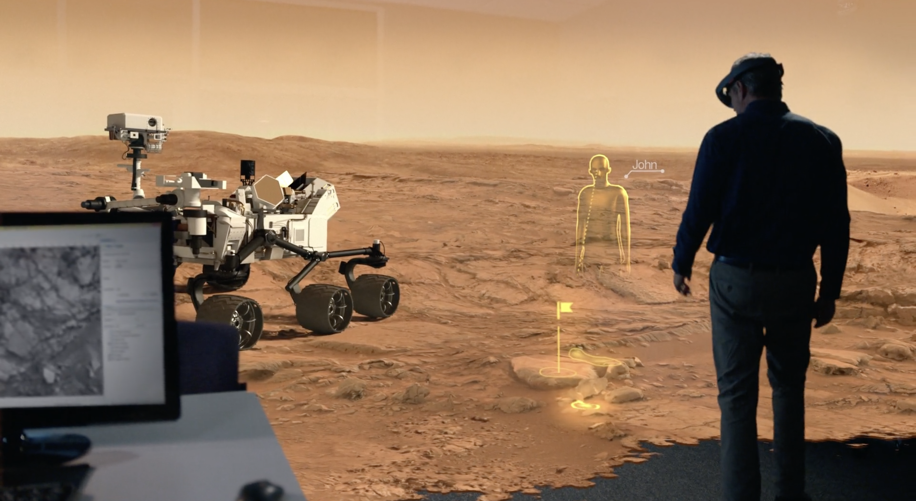
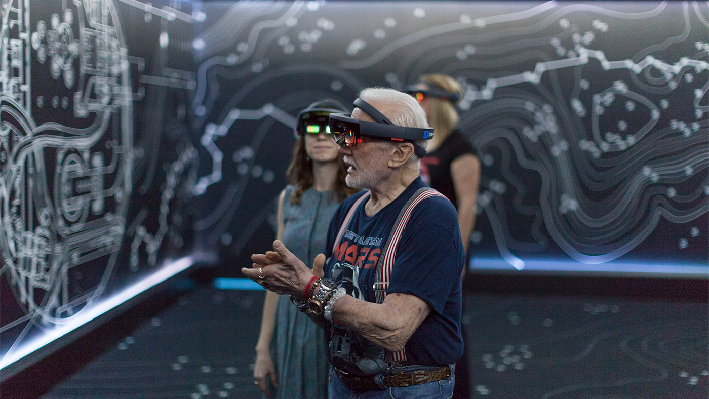
Onsight: A Mixed Reality Software Created by JPL and Microsoft
OnSight is an ambitious project created by NASA’s JPL in collaboration with Microsoft. It was designed for the HoloLens, allowing scientists, and researchers to collaborate and virtually walk on the planet Mars. The project has helped scientists understand the Martian geology using Curiosity data in real-time. It has also helped predict the Mars terrain and the challenges which could arise from Curiosity’s drives. The OnSight project has evolved into several subpaths, with Alice Winter, a user-experience researcher for OnSight, emphasizing the platform’s user experience.
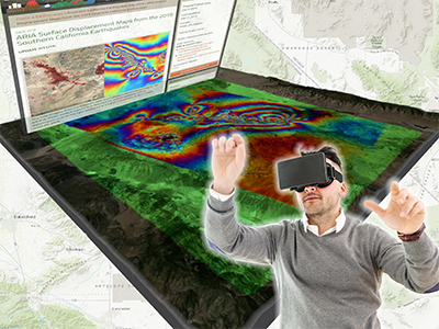
Virtual Reality’s Role in Disaster Management
Navteca, the NASA Applied Sciences Disaster Applications Group, and the NASA Information Technology Communications Directorate, have been researching virtual reality (VR) technology for its next generation of Earth Science technology information systems and advanced data visualization. The Disaster Applications Group’s primary objective is to promote the use of Earth observations to enhance disaster prediction, preparation, response, and recovery.
VR Migration for Disaster Scenario Visualization
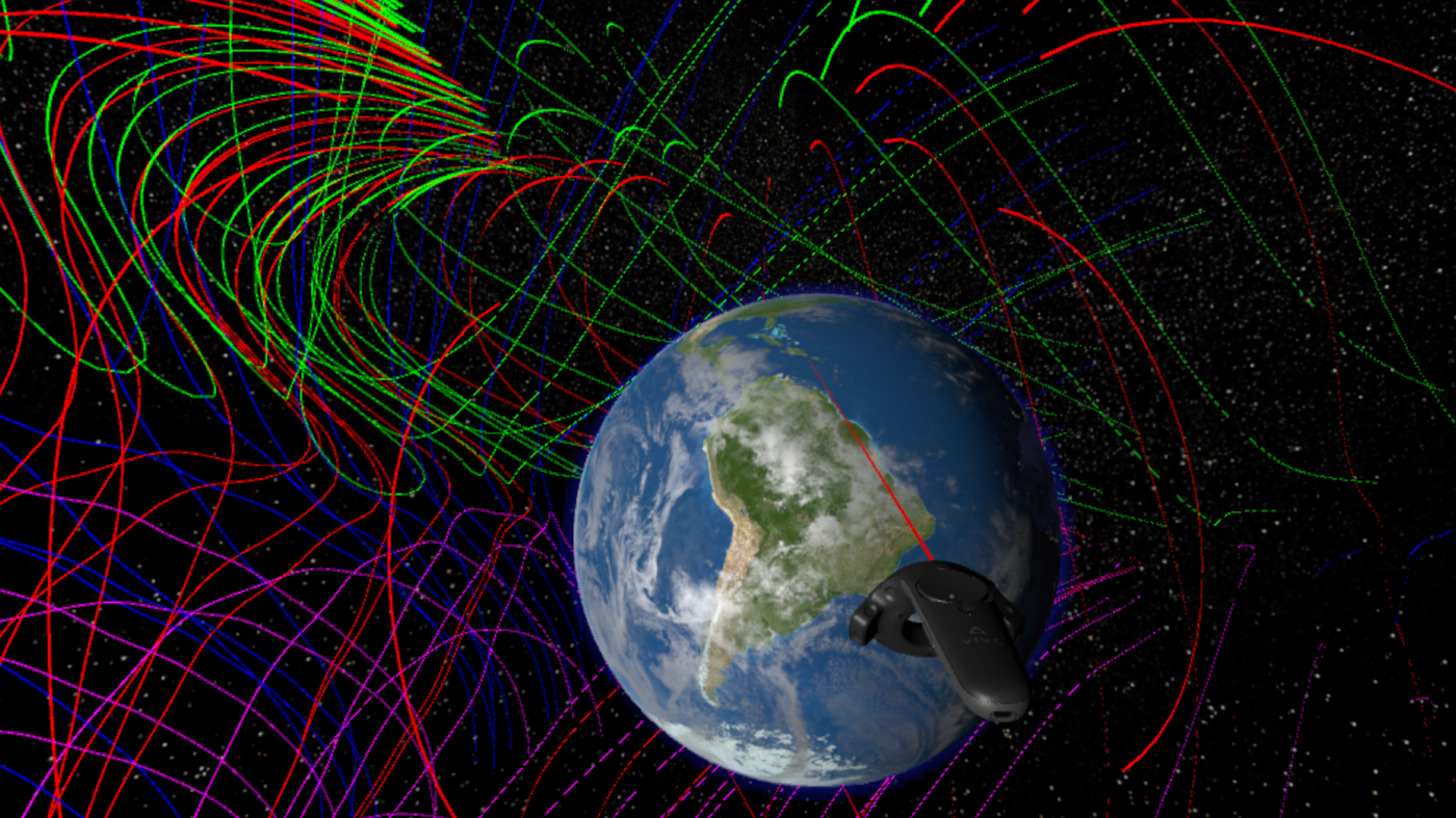
The NASA team began with an evaluation of the ArcGIS portal and data residing at the NASA Center for Climate Simulation (NCCS) and found it possible to query and serve disaster application data through an application programming interface (API). They developed an interface to 3D virtual city models, enabling users to view data from relevant disaster datasets in an immersive, interactive VR environment. New datasets were imported in near-real-time from NCCS, with the project team ingesting them into the VR environment without additional coding or development. The project focused on disaster scenarios to investigate whether VR technology could develop enhanced tools to help with disaster prediction, preparation, response, and recovery.
Conclusion
The rise in technology has greatly impacted the ability to process data across sectors. Virtual Reality technology and applications have drastically turned things around for the better within NASA’s JPL and are being investigated in numerous real-world scenarios as well. It’s still early days in the application of VR technology, and it could take several more decades for it to realize its full potential.
FAQs
Q1. What is Virtualitics?
Virtualitics is a company founded in 2016 by NASA’s JPL in collaboration with Caltech’s Ciro Donalek and George Djorgovski. The company created software that uses 3D visualization to examine relationships between data points. It incorporates AI features that complement the visualization to highlight patterns and correlations in data visualization.
Q2. What was the primary objective of the Disaster Applications Group at NASA?
The primary objective of the Disaster Applications Group within NASA’s Science Mission Directorate is to promote the use of Earth observations to enhance disaster prediction, preparation, response, and recovery.
Q3. What is Onsight, and what is its significance?
Onsight is a mixed reality software created by NASA’s JPL in collaboration with Microsoft. It was designed for the HoloLens and has helped scientists understand the Martian geology using Curiosity data in real-time. It has also helped predict the Mars terrain and challenges arising from Curiosity’s drives.
Q4. How does Virtual Reality impact data visualization?
Virtual Reality Technology enhances data visualization by providing seamless immersive experience with the data. VR enhances measuring distances, sizes, and help researchers to visualize and interact with more complex multi-dimensional data
Q5. What is ARC GIS data, and how was it used in NASA’s disaster management project?
The team evaluated the ArcGIS portal and data residing at the NASA Center for Climate Simulation (NCCS) to obtain relevant disaster scenarios data. The team found it possible to query and serve disaster application data through an application programming interface (API) to create immersive, interactive VR environments optimized for disaster scenarios visualization.